
Garfield Heights Neighbors Block Sources
A block search should answer one record question at a time. MyPlace shows a selected parcel and its mapped boundary. The Recorder identifies filings tied to a particular parcel or legal description. City maps show service or civic geography. A historic directory can show a printed address listing for its edition year. Treat each output as a distinct source rather than blending them into a current block roster.
| Source | What It Shows About a Block | Access |
|---|---|---|
| MyPlace parcel map | Separate parcel geometry and selected parcel details | Public City, Address, or Parcel search followed by View Map. |
| Official Recorder | Instruments for a particular parcel, lot, or legal description | Public index and image, plus Recorder counter or request route. |
| Garfield Heights city maps | Ward, zoning, flood, and rubbish-service geography | City Map Portal. |
| Board street-range product | Range, ward, precinct, ZIP, and district geography where released | Board product or public-record request process with legal exclusions. |
| Criss-cross or street guide | Dated printed address-to-household clue | CPL or County Archives, by edition and date. |
A displayed parcel owner is a property-interest field, not proof of every occupant, family member, guest, utility customer, or delivery recipient. The same boundary applies to a mailing address, which may be a correspondence location rather than the parcel's situs.
Map Garfield Heights Neighbors by Parcel
Use one map click at a time. MyPlace lets a researcher choose Garfield Heights and search by Address, Owner, or Parcel. After opening the correct result, use View Map to match the record to its parcel polygon. Then select only the parcels that actually touch or face the target under the map's boundaries. The research did not verify a dedicated buffer, radius, or neighbor tool, so no such capability should be assumed.
- Confirm the target delivery address with USPS, then find the parcel in MyPlace by City and Address.
- Open the matched Parcel ID and preserve its displayed site address, any separate mailing address, transfer detail, and legal-description clues.
- Select View Map only after the parcel is confirmed, then click each surrounding polygon as a separate parcel record.
- For each distinct parcel, preserve the parcel ID and source date; label any owner field as a displayed property interest.
- Use the Recorder for a specific parcel or legal description, read the image, and distinguish grantor from grantee.
The process is address to confirmed parcel to map polygon to separate adjacent parcel records to Recorder image. It produces a documented property trail for named parcels, not a claim that all Garfield Heights neighbors have been identified. For a full named street record chain, use Garfield Heights records by street.
Note: A nearby map label is not a selected parcel record, and a label should never be used in place of the parcel detail.
Garfield Heights Neighbors Recorder Layer
Cuyahoga Official Records Search supports a parcel-by-parcel method. Its advanced search includes party names and grantor or grantee modes, recorded and instrument date ranges, document type, document number, Parcel ID, volume or page, property address, document-image phrase, and legal-description fields. Parcel IDs use dashes. The document image and legal description are more reliable than a loose street-name match or unreviewed OCR.
Start only after the relevant parcel is identified. An instrument can establish a recorded party role, document type, recording date, and legal property relationship. It does not establish present occupancy, a household list, or the meaning of an adjacent parcel's correspondence address. If the chain becomes ambiguous, Recorder staff or the County Archives is a better route than inference.
The Recorder's recorded-document collection is stated to run from 1810 to the present. For older property gaps, the Archives supplies tax records, maps, and appraisal cards through its appointment and request channels. These are time-labeled layers, not a modern neighbor directory.
Garfield Heights Neighbors Civic Context
Community sources can explain how a block is organized without becoming a resident list. Garfield Heights has seven Council wards and publishes legislative materials and meeting information. Its map portal provides zoning, ward, rubbish, and FEMA flood layers. The research found a Garfield Heights Neighborhood Association organization resource and a city-linked Cuyahoga East Chamber directory, but no authoritative city inventory of neighborhood associations, HOAs, block watches, or public member rosters.
| City map portal | Interactive and printable map routes for ward, zoning, rubbish, and flood context. |
|---|---|
| City Council | Seven-ward civic and meeting-material route. Use ward information for public civic context, not private contact reconstruction. |
| Garfield Heights Neighborhood Association | Organization bylaws resource, not a public member directory. |
| Cuyahoga East Chamber | City-linked community and business directory route, not a resident roster. |
Contact an organization through its own published route for a civic or historical question. Do not represent bylaws, a Chamber listing, a meeting notice, a school item, or a photograph as a list of people living on a block.
Garfield Heights Neighbors Geography Myth
Ward, precinct, ZIP, city, and parcel lines do not overlay each other. The city lies among Cleveland, Maple Heights, Valley View, and Cuyahoga Heights, and its current road context includes Turney, Broadway, Granger, Rockside, and I-480. Those corridors can help orient a map, but they do not replace a legal description or Parcel ID. The Board's precinct map was revised February 5, 2026, while the city map portal supplies current municipal layers.
Myth: nearby addresses necessarily share the same civic geography. Fact: a block can cross a ward, precinct, postal, or municipal convention boundary. Verify the map layer that answers the actual question, and keep the date of the map visible. The Board's street-range product can add range and district context, but it does not disclose ballot choices or remove protected voter limits.
The historical layer has its own place-name issue. The area was South Newburgh from 1907 before Garfield Heights was established in 1930. A dated directory or map search may need both names and a current parcel or street reference to keep the geographic trail coherent.
Garfield Heights Neighbors in Dated Directories
For an older block question, use a city directory's street guide or criss-cross section for a specified edition, then compare an earlier or later available edition. Cleveland Public Library's guide identifies city, criss-cross, and telephone directory resources, while County Archives lists Cleveland City Directories from 1837 through 1972, not inclusive. The CPL guide notes reverse or criss-cross address listings in its 1929-era directory material.
A dated address line can be paired with an Archives map or tax period and a deed. The result should remain limited to the printed edition and address. It does not establish current Garfield Heights neighbors or every person who lived in the building between editions. The historical place name, exact street spelling, and publication year belong in the citation.
Garfield Heights Neighbors Source Comparison
Official systems provide records with a known custodian, date, and scope. Commercial neighbor-search categories can combine public and commercial data, but their household associations may be stale, incomplete, or wrong. A comparison should favor the source that directly answers the narrow question and allows a correction through the originating office.
| Source type | Best use | Key limit |
|---|---|---|
| Official parcel, Recorder, or city map record | Parcel boundaries, recorded instrument facts, and published civic geography | Each source has a defined scope and does not list every occupant. |
| Board product or public-record request | Published street-range or voter-record geography under the Board's procedures | Protected fields and registrations remain excluded; ballot choices are secret. |
| Commercial neighbor-search category | A lead that needs independent verification | Can merge stale or incorrect household associations and has no authority to correct the original public record. |
For a correction, use the office that created or maintains the item. MyPlace itself cautions that it is a convenience tool, while the originating Fiscal Office, Recorder, Board, or Court retains the authoritative record role.
Garfield Heights Neighbors Limits on Other Lookups
An offender or custody search is not a block-neighbor tool. The Ohio Department of Rehabilitation and Correction search covers people in Ohio prison, under Department supervision, judicially released, or violators at large, with its own last-name, first-name, county, status, and other fields. A residential ZIP or county field has limited status scope and may be a last recorded address, not a verified present location. Do not use it to locate or contact someone.
The Ohio Offender Search source documents the state-custody search and its narrow scope.
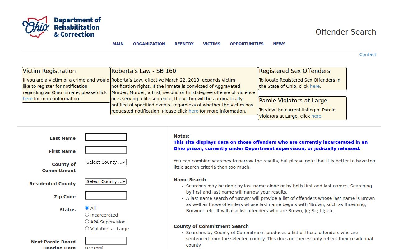
The source belongs only to a defined state-custody status question and cannot support a statement about who lives on or near a Garfield Heights block.
Garfield Heights Neighbors Privacy Limits
Public records have real boundaries. Safe at Home participants can use a substitute address, qualifying public service workers can seek address redaction, and confidential voter registrations do not appear through the ordinary public path. Court records can be sealed or restricted. Motor-vehicle address data are not an open local search. Do not use other records to reconstruct a protected address or to infer private household facts.
Ohio's Public Records Act permits access to qualifying existing records, but an office may redact a legal exception and does not have to create a new compilation. Garfield Heights directs defined requests to PublicRecordsRequest@garfieldhts.org. Give the record type, date range, and address, parcel, or case number. That makes a request more useful than asking an office to identify people from loosely related data.
Lawful use. Use block records for lawful personal, property, family-history, or civic questions. Do not use them to stalk, harass, expose, follow, or intimidate anyone.