
Trace a Garfield Heights Street by Address
For a Garfield Heights street, begin with the physical address and select the matching municipal parcel in Cuyahoga MyPlace. Save the displayed Parcel ID, site address, transfer clue, and legal-description details. Open the parcel's document list, then use the Parcel ID with dashes in the county recorder index. A deed can establish recorded parties and a land interest. It does not establish that each recorded party lives at the property, and a current owner display does not identify every person at the address.
- Verify the delivery address, then select City = Garfield Heights and Address in MyPlace. Choose the actual parcel record instead of relying on a map label.
- Record the Parcel ID, the separately labeled site or situs address, and the legal description. Treat a mailing address as correspondence information, not a residence claim.
- Use Transfers or Get a Document List to locate an apparent transaction, then search the parcel or parties in the official recorder index.
- Read the instrument image. Match its grantor, grantee, recording date, document number, and legal description before connecting it to the parcel.
- For a dated household clue, consult the appropriate street guide or criss-cross directory at the library or Archives. For voter geography, use the Board's published products and observe redactions.
Each stop answers a narrower question. The parcel screen supplies a lead, the instrument supports a recorded land relationship, and a directory gives a dated printed listing. None is a complete current street roster.
Note: Preserve the source date and the exact address spelling at every step, especially when comparing records from different decades.
MyPlace Fields for Garfield Heights Streets
MyPlace is the county's practical front door for a Garfield Heights address. Its first screen narrows a search by city and lets the researcher use owner, parcel, or address mode. After a parcel is opened, the tabs can lead to transfers, values, land, building information, permits, taxes by year, and a document list. The county describes this as a convenience compilation. The originating office and recorded instrument remain the source to check for an official record.
| MyPlace field or control | Type | When used | Garfield Heights result |
|---|---|---|---|
| City | Drop-down | Choose first | Narrows the search to Garfield Heights. |
| Search By | Mode selection | Required | Owner, Parcel, or Address. |
| Search | Text input | Required | Enter the chosen owner, parcel, or address value. |
| View Map | Button or link | After a result | Shows the spatial parcel view. |
| Parcel ID | Result link | After a match | Opens parcel-specific details and tabs. |
| Get a Document List | Recorder link | Parcel-specific | Connects the parcel lead to recorded documents. |
MyPlace has no separately verified ZIP-only search field. It is also important to read the label beside an address field. A site address identifies the parcel's physical place, while a mailing address can be somewhere else. A street directory result should never turn the latter into an unverified claim about a person's location.
Original Deeds in a Garfield Heights Street Directory
The Cuyahoga Recorded Documents office states that filed recorder documents, including deeds, are searchable from 1810 to the present. For one Garfield Heights parcel, use the parcel number, party name, date range, document number, property address, or legal-description field as appropriate. The index's OCR is a useful lead, but the document image carries the text that must be compared against the parcel and parties.
The county's Recorded Documents page identifies the recorder route and access channels for a parcel record.
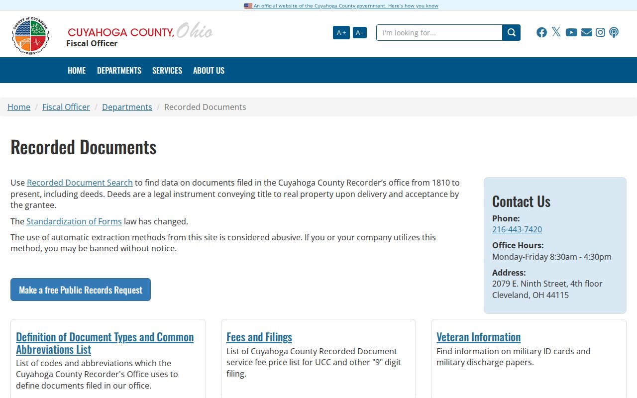
Use the displayed contact or public-record request route when an image, a plat, an older issue, or a certified copy needs clarification. A filed deed records an instrument and its parties. It should not be read as a complete account of everyone who lived on that street.
Garfield Heights Street Directory Record Sources
Address-keyed sources serve distinct purposes. The table separates land facts, geography, municipal project records, and historical household leads so a Garfield Heights street search does not blend them into one unsupported conclusion. Most current ownership work begins in the county. City layers can explain a boundary or a project address, while historical directories and voter products have their own dates and limits.
| Address record | Custodian | What it can support | Important limit |
|---|---|---|---|
| MyPlace parcel record | Fiscal Office | Parcel, owner display, transfers, value, building and tax links | Convenience data, not the official record. |
| Recorded instrument | Fiscal Office | Grantor, grantee, document date, number, and legal description | Recorded party role is not a current-residence finding. |
| Tax, map, and appraisal material | Fiscal Office and County Archives | Property, value, lot, and historic-context clues | Requires date and parcel reconciliation. |
| Permit or inspection file | Garfield Heights Building Department | Project address, work, and file context | Not a household record; redactions may apply. |
| Directory or criss-cross guide | CPL and County Archives | Dated address-to-printed-occupant lead | Year-specific and not a full household account. |
| Board street-range product | Cuyahoga Board of Elections | Street, range, precinct, ZIP, and district geography | Protected registrations and secret ballots stay private. |
For a disputed street-to-parcel connection, retain the Parcel ID and legal description. Those identifiers are stronger than a street name alone, particularly when a lot was split, combined, or described differently in an older record.
Garfield Heights Permit Addresses
The city's Permits page provides forms for building, concrete, electrical, HVAC, plumbing, sewer, demolition, fences, garages, sheds, signs, street openings, pools, planning, and zoning matters. The general building application contains an Address of Project field and a PP Number field. Those fields make a permit useful for dating a project or locating a municipal file, but not for identifying a full set of people at the place.
The Garfield Heights permit office publishes the forms and local code links used for an address-specific request.
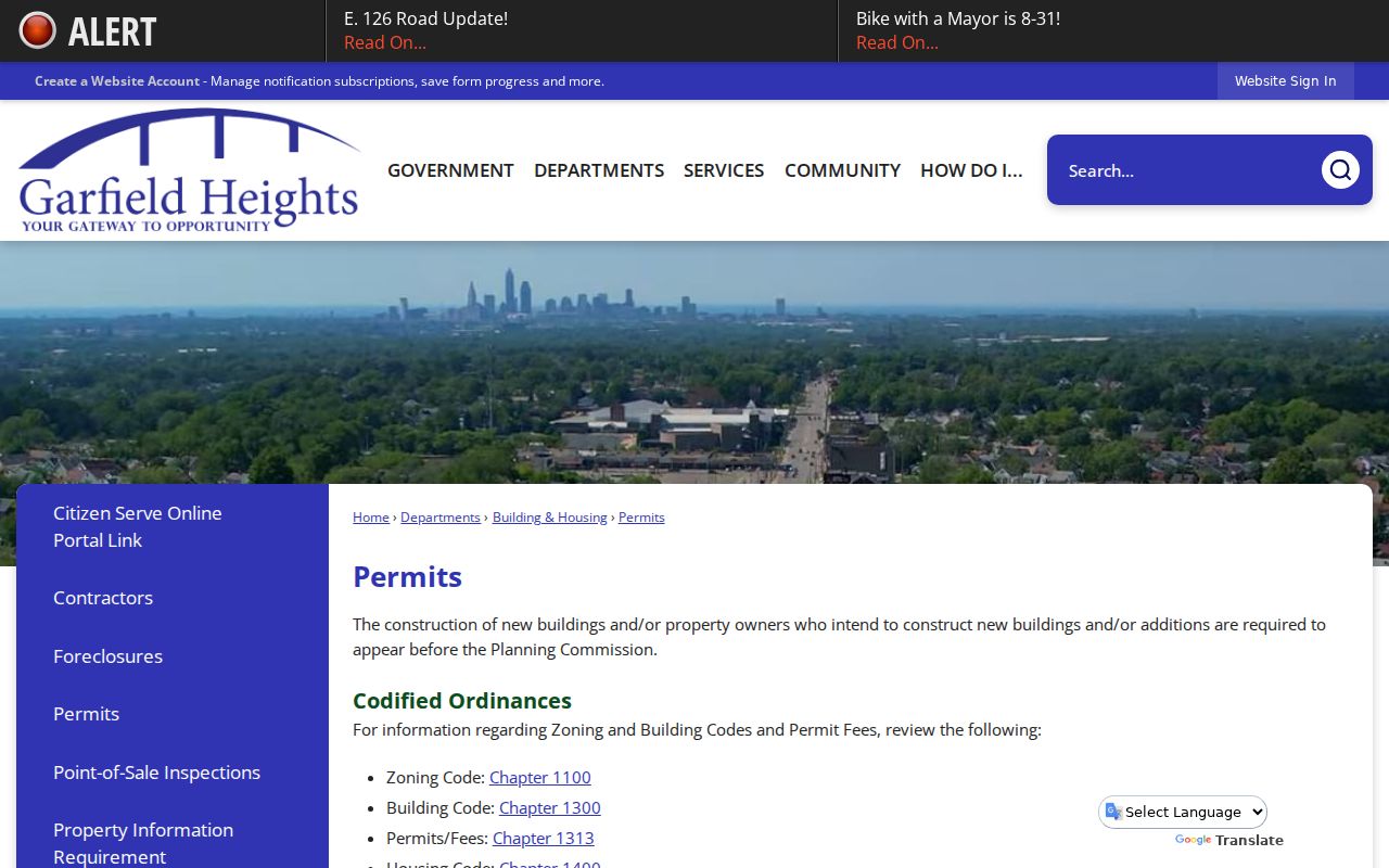
The city also directs users to CitizenServe, though the research did not verify its live public search fields. An application can be sent in person, by fax, or by email to the Building Department, and the department says emailed applications are processed within two business days. Ask for a defined project record by address and time range rather than assuming the portal publishes a complete history.
Note: A permit applicant or contractor connection documents a project file, not a statement that the person resided at the property.
MyPlace Leads, Recorder Originals
Insider tip. Let MyPlace identify the parcel, then let the recorded instrument test the ownership fact. The county's Transfer and Recording division maintains ownership history, transfers, property-tax maps, and plats. Its staff cannot give legal advice, so a complicated title sequence needs the actual document, the counter, or an archive appointment rather than a conclusion drawn from an on-screen summary.
Transfer and Recording is the county route behind the title and map work used in a Garfield Heights street directory search.
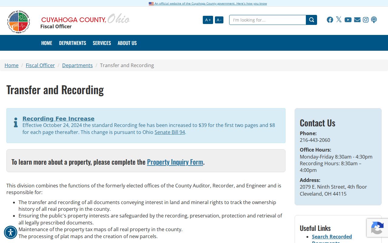
The counter is at 2079 East Ninth Street, fourth floor, Cleveland, with recording through 4:00 p.m. on weekdays. It is a verification route when a parcel chain has a correction, estate instrument, subdivision change, or another document that breaks an ordinary sale sequence.
Garfield Heights Street Geography Layers
Myth. A postal ZIP, city boundary, ward, precinct, and parcel line are not the same geography. Garfield Heights addresses and parcels use 44105, 44125, and 44128 in the documented local sources, yet those ZIPs do not prove municipal jurisdiction. Confirm the exact delivery address through USPS, then select Garfield Heights in MyPlace and use the city or county map for the relevant boundary question.
The Garfield Heights Map Portal offers interactive zoning plus printable zoning, ward, rubbish, and FEMA flood maps. These are useful for locating a street in the municipal service landscape. They do not prove ownership. For that, return to the fiscal-office parcel record and the recorder instrument.
Published maps show corridors such as Turney, Broadway, Granger, Rockside, and I-480, but the research did not verify a citywide numbering formula, citywide renumbering date, or a street-name-change crosswalk. Keep the spelling printed in each dated source, then use the parcel and legal description to bridge an old label.
Dated Garfield Heights Street Listings
A historical street directory is a dated compiled lead, not a substitute for the present parcel record. Cleveland Public Library holds listed Garfield Heights directory editions for 1954-55, 1956-57, and 1962, plus selected East Suburban Directory editions from 1964 through 1979. Its genealogy guide also identifies city, telephone, and criss-cross directory material. The County Archives lists Cleveland City Directories from 1837 to 1972, not inclusive, so a particular year must be checked with the catalog or archivist.
Use the street-and-avenue or householder section to confirm the exact printed number in one edition. Compare an earlier or later available volume, record the edition year, and test the sequence with a deed, tax record, map, probate record, or census. The historical collections themselves are described in the Garfield Heights city directories.
Garfield Heights Street and Voter Products
Ohio's My Voter Information is a person-specific confirmation screen. It requires first name, last name, and county, and is not a browse-by-street tool. For an address or precinct research question, the Cuyahoga Board's city and district data route includes Garfield Heights. The Board's published product list also describes a street-range guide with odd and even ranges, ward, precinct, ZIP, and legislative or school-district geography.
Public voter records have statutory exclusions. Social Security information, driver or state-ID information, phone and email data, confidential registrations, protected-worker addresses, and other protected fields are not available for routine release under R.C. 3503.13. Ballot choices are secret. A street directory should preserve those boundaries and use the Board's request procedure only for the defined public product needed.
Note: During the statutory election window, the Board may limit copying if it would interfere with election administration.
Garfield Heights Street Directory Terms
Address research becomes clearer when each identifier keeps its own meaning. These terms help prevent a street directory search from merging land data, correspondence data, and a printed household clue.
- Parcel
- A county-defined unit of land with an identifying number. It connects the MyPlace result, tax material, maps, and recorder search.
- Situs address
- The physical property address used for the parcel. It is different from a separately labeled mailing address.
- Plat
- A recorded map or plan showing lots, blocks, subdivisions, or other land layout. It helps reconcile a legal description with a street location.
- Criss-cross directory
- A reverse address guide that can lead from a street and number to a printed, date-specific listing. It is not proof of legal title or current presence.
Garfield Heights Street Document Access
The official index is a normal starting point, but it is not the only access channel. The Recorded Documents page links a free public-records request route, and the recorder counter can help with a document image, plat, older issue, or copy question. A focused request should give a document number, book and page if known, party names, parcel, and whether inspection, an ordinary copy, or certification is needed.
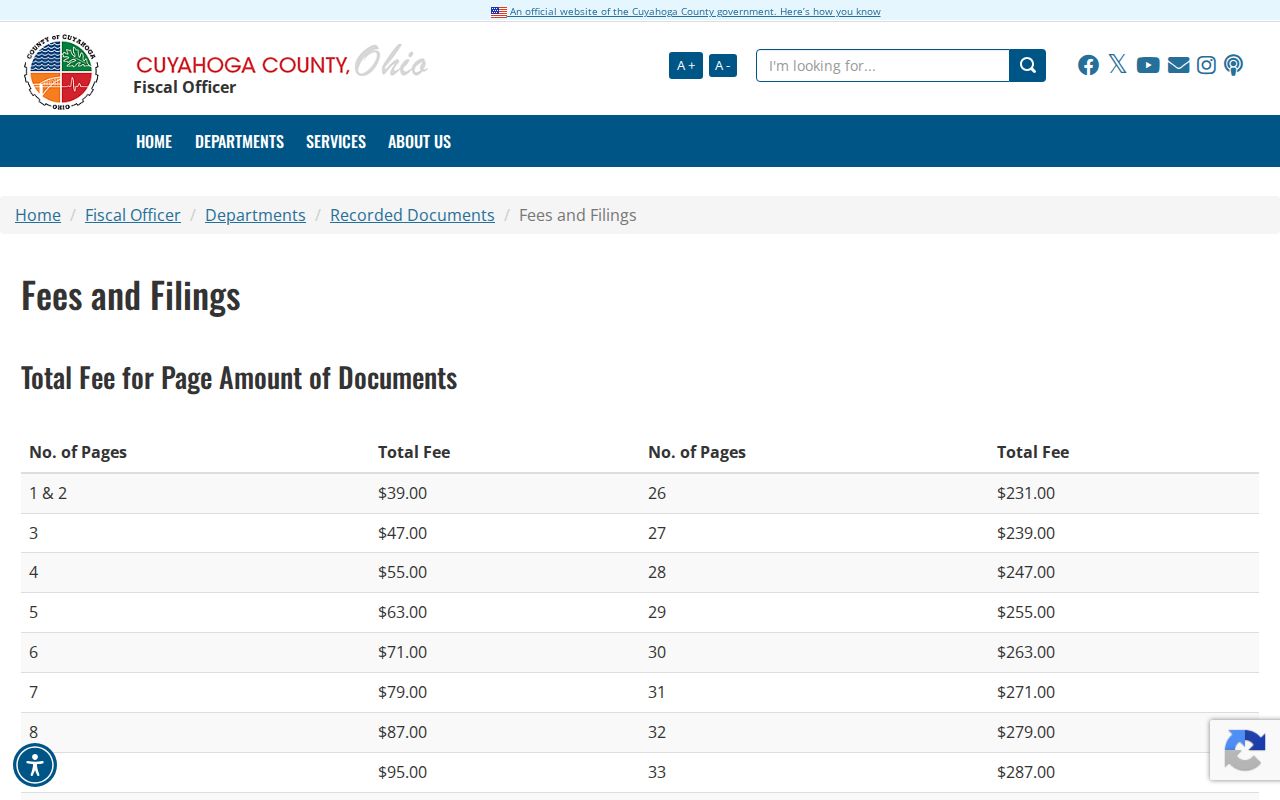
Cuyahoga's fees and filings page lists current copy and certification charges. It lists recorded-instrument copies at $2 per page and a $2 additional charge for a certified copy. Those are copy charges, not a fee to enter a search term in the public portal.
For older maps and tax material, the County Archives offers a separate path. Its property-research service is appointment-based and is designed for the moment a current address or online index stops resolving a historic parcel question.
Limits of a Garfield Heights Street Directory
A Garfield Heights street directory can support a careful description of a parcel, a recorded instrument, a municipal project file, a precinct geography, or a dated directory listing. It cannot establish every current occupant, household member, guest, utility customer, postal-forwarding recipient, DMV address, or protected person connected to a place. A map polygon and a property owner field should not be turned into a list of people who live there.
Ohio Safe at Home participants, confidential voter registrations, protected public-service-worker addresses, sealed court information, and legally redacted fields remain protected. The right approach is to use a stated public record for a defined personal, family-history, estate, or property-curiosity purpose, then verify important facts with the office that holds the original.
Lawful use. Garfield Heights address records support personal, lawful research and careful property history. Do not use a name, address, or record to stalk, harass, intimidate, or harm anyone.
Note: When the evidence stops at a map label or a mailing field, describe that limit instead of inferring a resident.